 Featured projectSentinel-2 imagery, as published by OroraTech.
The Palisades Fire, visualized
A geographic story about a changing landscape, built with MapLibre and Scrollama.
Explore the projectCartography & geospatial development
I’m Jesse, a mapmaker and geospatial developer. I turn geographic data into maps and interactive stories.
Discover my workFrom pixels and data to pen and paper.
Different mediums. A shared curiosity.
Featured projectSentinel-2 imagery, as published by OroraTech.
A geographic story about a changing landscape, built with MapLibre and Scrollama.
Explore the project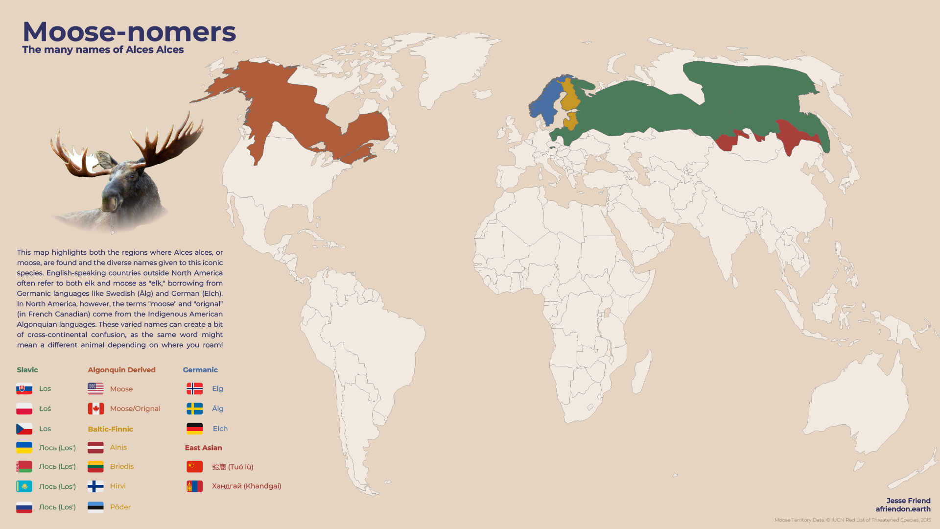 02
02
Where moose live, and the many names they go by.
 03
03
Japan’s changing population, seen in three dimensions.
 04
04
A fire season’s satellite detections, stacked in 3D hexagons.
 05
05
The arctic fox’s circumpolar range, and its fragile foothold in Fennoscandia.
 06
06
IPC food insecurity classifications on a rotating globe.
 07
07
An interactive globe of certified International Dark Sky Places.
 08
08
Thomas Stevens’s 1884–1886 ride around the world.
 09
09
Finding a different kind of relief in Sweden’s terrain.
 10
10
A view of the Bavarian Alps, with pen and paper.
 11
11
A contemporary map in a historical visual language.
 12
12
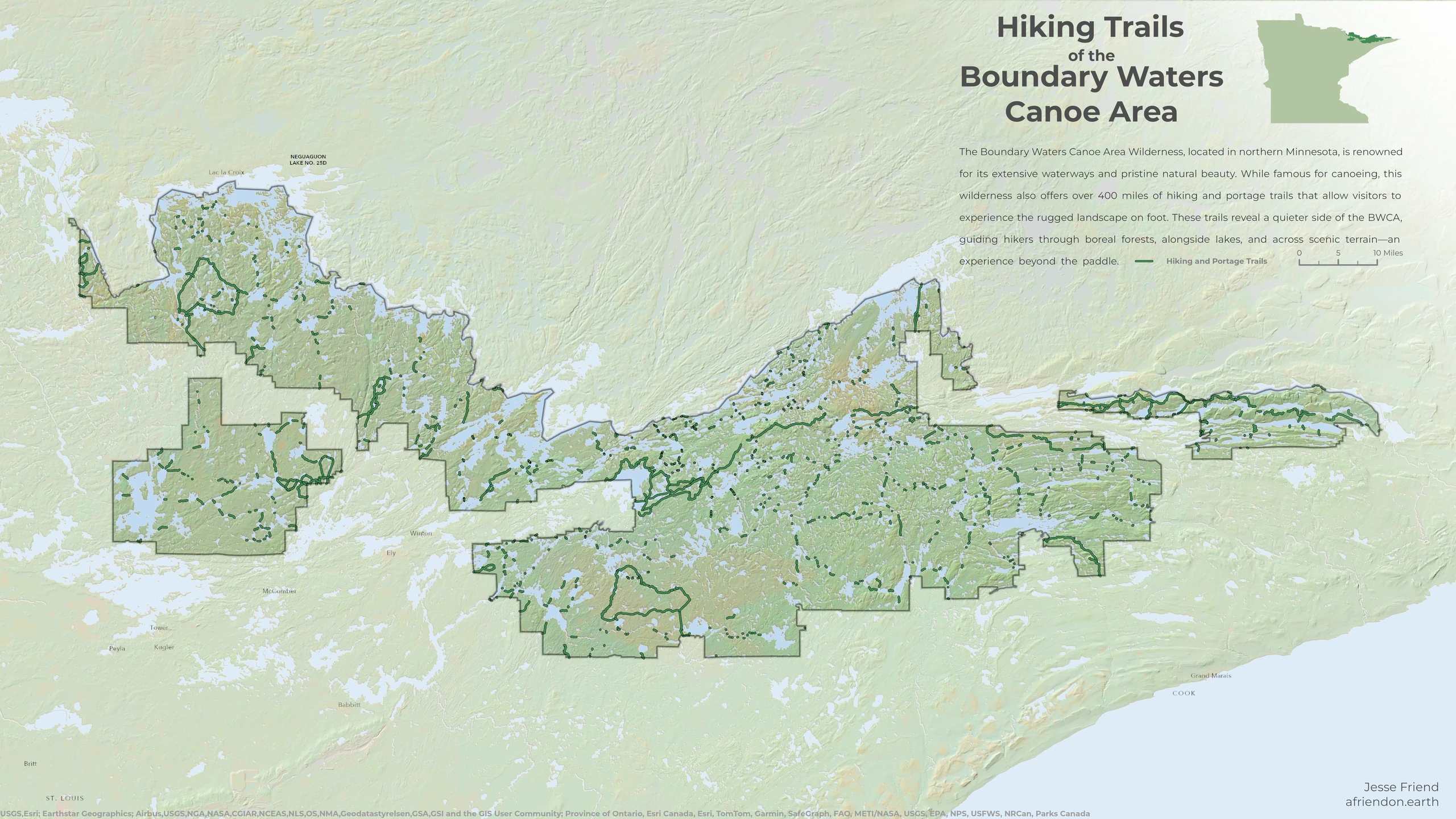
Hiking and portage trails in Minnesota’s Boundary Waters.
02 / About
I work between cartography and code, making geographic information easier to understand and explore.
My projects range from interactive stories and 3D maps to terrain studies and drawings from a mountain trail. The medium changes; the curiosity about place stays.